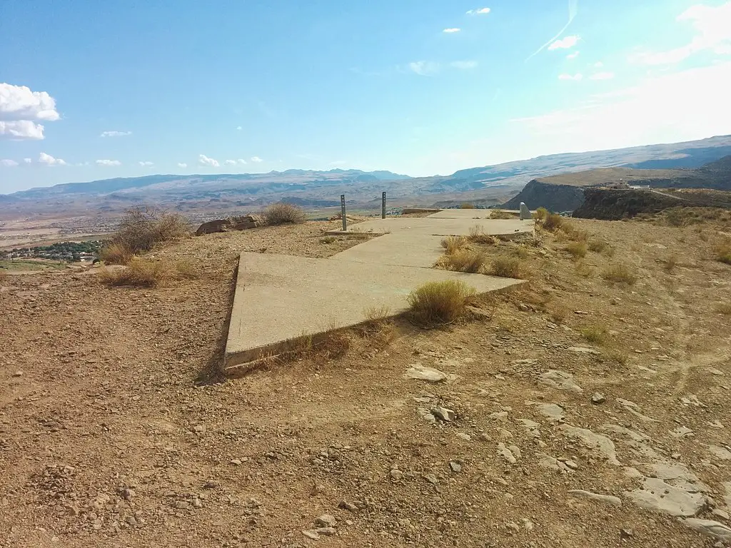
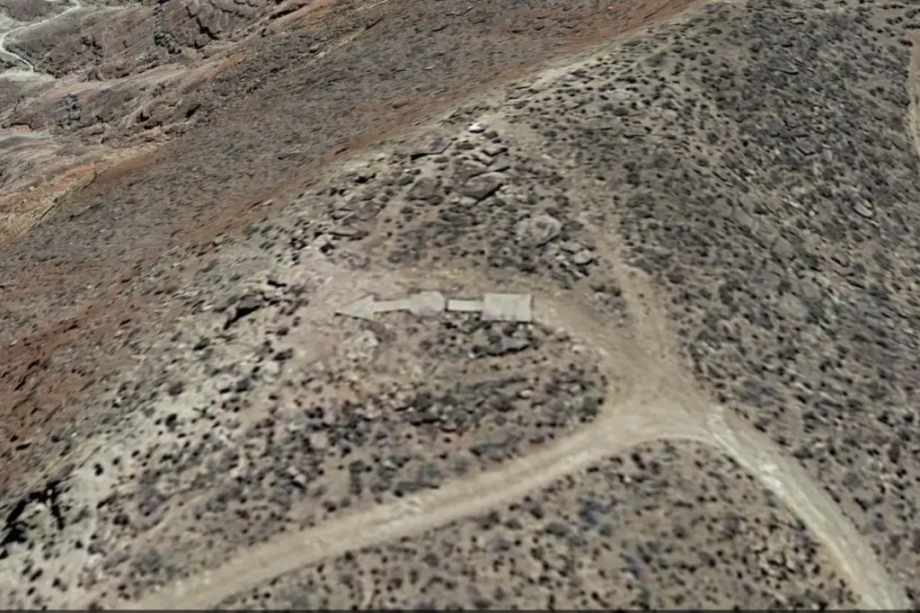
In the late 1920s and early 1930s, the United States Department of Commerce constructed concrete arrows on the ground across the U.S. to provide a navigation guide for the pilots flying airmail across the country long before there was GPS. What remains today are abandoned concrete arrows dotting the U.S. landscape.
In 1911, pilots began making experimental daily mail flights dropping mailbags from Garden City Estates, New York, to Mineola, New York. In 1918, the Post Office Department started its first scheduled airmail service between New York and Washington, D.C. Pilots relied entirely on using landmarks and dead reckoning to complete the route.
The Post Office Department then developed plans to offer a long-range, transcontinental airmail route. It instituted one in 1920 from New York to San Francisco, with stops in cities along the way. The mail was carried by train at night and flown during the day. On February 22, 1921, a flight was flown day and night the entire distance. This flight convinced Congress to fund and expand the airmail service.
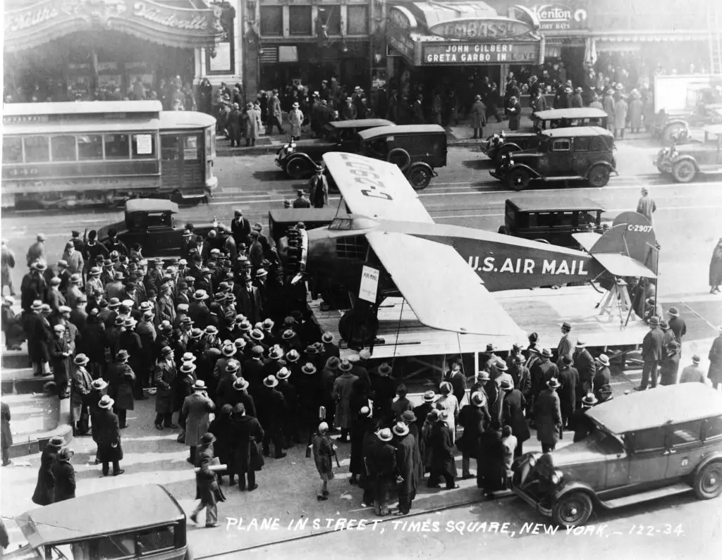
Airplanes were outfitted with luminescent instruments and navigation lights during this time, and a lighted airway began to be built along points of the route in 1924. Every 25 miles from Chicago to Cheyenne, Wyoming, there were emergency landing fields, and these were between five regular landing fields in a particular section of the route.
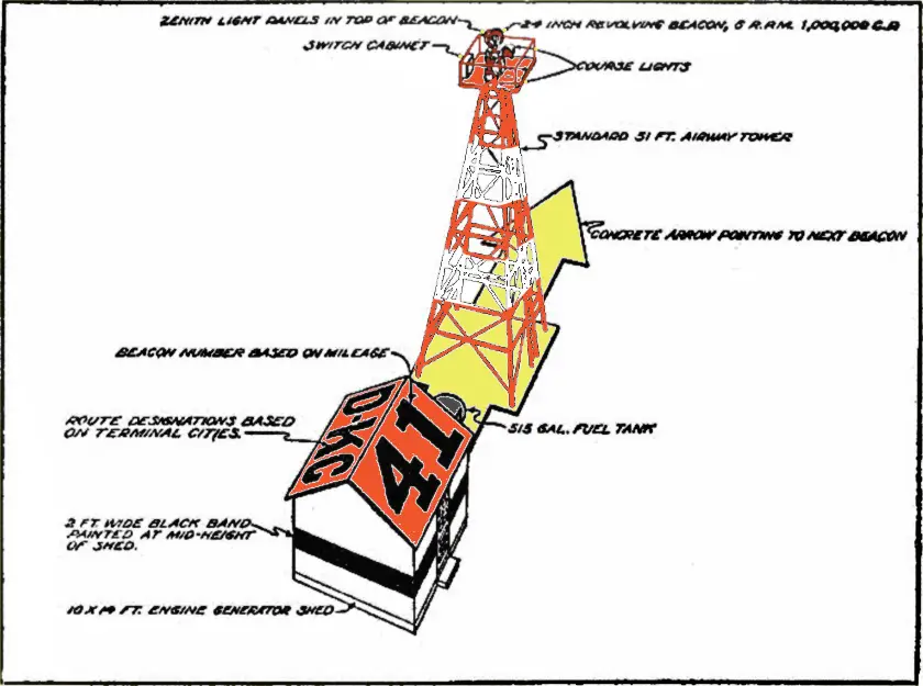
At these regular fields, beacons were installed and visible up to 150 miles, while beacons at the emergency fields between were visible for 80 miles. In addition, 289 acetylene-powered blinker beacons were installed every three miles, which were visible up to nine miles. By 1925, the lighted airway went from New York to Salt Lake City.
This same year, the airmail service was contracted out to commercial aviation companies, and in early 1926, the first commercial airmail flight was made. As this change occurred, the Post Office Department transferred all the lights, landing fields, beacons, and airways to the Department of Commerce. The Post Office Department would continue to deliver the mail, but commercial airmail companies did all the flying, and the Commerce Department managed the airway.
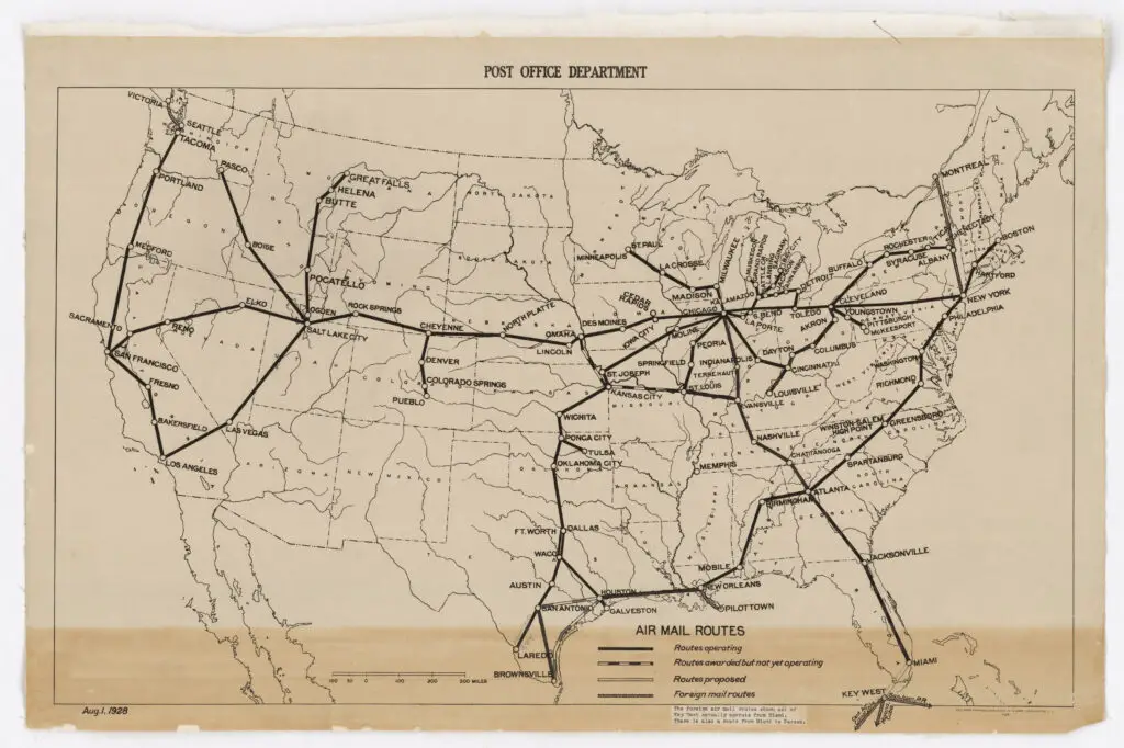
When the Air Commerce Act of 1926 was signed into law in May 1926, the Commerce Department began an overhaul of the navigation on the airmail routes. This was when the department started constructing the concrete arrows.
The arrows were built between 1926 and 1931. Each site consisted of a large bright yellow concrete arrow 70 feet in length pointed toward another beacon site, along with a 50-foot-tall rotating beacon nearby that helped illuminate the site. Each beacon was about ten miles apart and had an alphanumeric designation. They were powered by an on-site generator when not near power lines and had a tender to ensure they operated successfully.
The Transcontinental Airway System consisted of 1,500 concrete arrows that spanned 18,000 miles of delivery routes. But by the 1940s, radio and radar development was already overtaking the usefulness of the lighted beacons as they couldn’t be used in bad weather, and now pilots were no longer alone in the air.
The beacon sites were replaced with non-directional radio beacons (NDB) and very high-frequency omnirange stations (VOR), a short-range radio navigation system for aircraft. These were placed in other areas and much farther apart.
The beacon sites were dismantled and recycled over time though some were saved or restored. What was usually left was nothing but the concrete arrows pointing off in a specific direction. The sites were officially decommissioned in the 1970s. Here’s where you can see the beacon stations that are left in the United States today.
Sources: USPS, General Aviation News, Cowboy State Daily, CNN, Dream Smith Photos

